
The Landscape Grand Pré
Facing North - from the View Park towards the expanse of dykelands of the World Heritage Site. To the east and west are dykes protecting the active agricultural landscape. The Memorial Church at Grand-Pré National Historic Site can be seen in the middle distance; Long Island is to the north of the dykelands and the cliffs of Blomidon in the distance.
|
First developed by the Acadians in the 1680s, the dyked lands, fields and village on the hills were then taken over and enlarged over the years by descendants of the Planters of New England, then by immigrants, including English and Scots, in the 19th and 20th centuries, and the Dutch, after World War II.
Majestic Cape Blomidon towers over the site's 1,111 hectares (2,745 acres) of diked land. According to Mi’kmaw legends, the giant Kluscap (Glooscap) watched over his people from this promontory. |
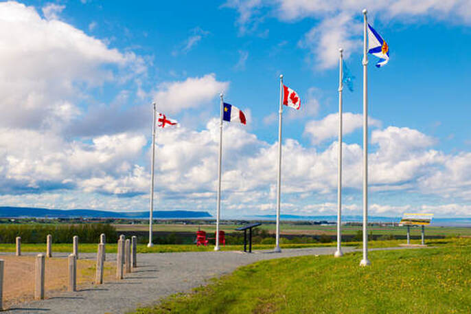
© Jamie Robertson
|
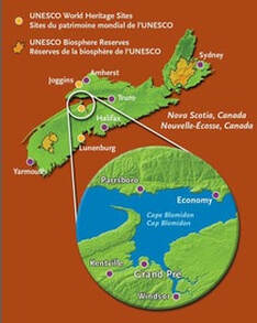
Grand Pré, Nova Scotia, Canada
|
Getting here is easy and the beautiful scenery will have your camera working overtime. If you are operating an onboard GPS, just set your course for the following:
Latitude: 45.102319 Longitude: -64.305423 |
|
Driving Directions to Grand Pré
Coming from Halifax, Nova Scotia (about 45 minutes):
Grand Pré is located in the Annapolis Valley, about a 45-minute drive from Halifax going west. From highway 101, take Exit 10 towards Wolfville and follow Route 1 west for one kilometre then turn right on Grand Pré Road (just past the gas station). Visitor services are available during tourist season at Grand-Pré National Historic Site of Canada located on Grand Pré Road on the left side before arriving on the marshlands.
Coming from Moncton, New Brunswick (about 3 hours):
From Moncton, head towards Route 2 E/Trans Canada Highway toward Sackville/Nova Scotia. Cross the provincial border which becomes NS Highway 104. Please note: this is a partial toll road. After about 45 minutes, take exit 15 to merge onto NS Highway 102 South toward Halifax/Truro. Take exit 4B to NS highway 101 towards Lower Sackville/Windsor. Take exit 10 to Grand Pré/Wolfville. Follow Route 1 west for one kilometre then turn right on Grand Pré Road (just past the gas station). Visitor services are available during tourist season at Grand-Pré National Historic Site of Canada located on Grand Pré Road on the left side before arriving on the marshlands.
Coming from Saint John, New Brunswick via ferry:
Take the Princess of Acadia ferry from Saint John, New Brunswick to Digby, Nova Scotia. The ferry runs daily and takes just three hours to cross the Bay of Fundy. From the Digby Ferry Terminal take Highway 101E (The Evangeline Trail) to Exit 10. Turn left. Follow Route 1 west for one kilometre then turn right on Grand Pré Road (just past the gas station). Visitor services are available during tourist season at Grand-Pré National Historic Site of Canada located on Grand Pré Road on the left side before arriving on the marshlands.
For accommodation in the Grand Pré and Wolfville areas, see:
http://www.valleytourism.ca/
http://www.novascotia.com